
Search Collections
- Object[996]
- no[996]
- american[996]
- animal bone[1]
- animal bone fragment[8]
- animal tooth[6]
- antler fragment[1]
- archaeological material[1]
- baked clay[1]
- basketry[1]
- bead[1]
- beads[1]
- bone fragment[1]
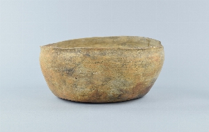
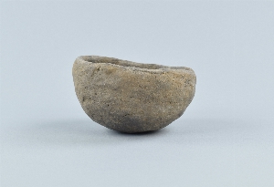
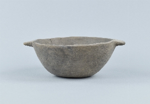
- bowl[4]
- canteen[1]
- charcoal[7]
- conglomerate[1]
- cuff[4]
- cup[1]
- dance rattle[1]
- dice[1]
- disc[7]
- figurine[1]
- jar[1]
- jar sherd[7]
- lamp[4]
- lithic[14]
- lithic fragment[3]
- lock[1]
- mollusk shell[7]
- mortar[1]
- net sinker[1]
- net sinkers[1]
- ornament[1]
- pebble[1]
- pestle[2]
- pipe[1]
- pipe bowl[2]
- pipe bowl fragment[1]
- pipe fragment[3]
- pipe stem[1]
- pitcher[1]
- pot[4]
- pot fragments[1]
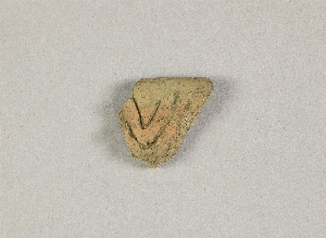
- pot sherd[40]
- potsherd[81]
- potsherds[35]
- pottery[1]
- pottery fragment[59]
- pottery fragments[17]
- pottery sherd[1]
- rim sherd[26]
- shell fragment[3]
- sherd[696]
- sherds[9]
- stone[2]
- stone fragment[1]
- tortoise shell[3]
- vase[1]
- vessel[1]
- vessel foot[1]
- vessel fragments[1]
- water jar[1]
- wood fragment[1]
- adam's place[6]
- alaska[91]
- anvik[6]
- anvik point[7]
- anvik river[13]
- atlantic county[1]
- aurora (new york)[1]
- bartlett shellheep[1]
- bonasila[30]
- bonasila beach[19]
- brandywine[1]
- bucks county[16]
- burlington county[12]
- burlington island[1]
- camden (new jersey)[3]
- camden county[3]
- cape henlopen[12]
- cayuga county[1]
- chester county[9]
- chestnut neck[1]
- chickies[1]
- clinton county[594]
- columbia (pennsylvania)[1]
- cooper's creek (new jersey)[3]
- cumberland county (new jersey)[45]
- dauphin county[1]
- delaware[25]
- delaware valley[10]
- delaware water gap[1]
- east greenwich township[1]
- eleven-mile village[6]
- florida[2]
- fort ticonderoga[1]
- frank fox's place[7]
- french creek[7]
- gloucester county[50]
- greenwich township[37]
- gum island[3]
- halls island[1]
- hamilton[6]
- hamilton square[6]
- hologochaket[2]
- holy cross[7]
- hummelstown cave[1]
- illinois[1]
- indian mills[2]
- innoko river[2]
- kaiyuh slough[11]
- kaltag[3]
- kashim[6]
- kateel[9]
- kent county (delaware)[11]
- khotol river[11]
- kimberton region[7]
- kintnersville[3]
- koyukuk river[9]
- kugusugaruk[5]
- lancaster county (pennsylvania)[34]
- lewisburg region[2]
- lock haven[594]
- locust grove[1]
- lower yukon river valley[70]
- medford[2]
- mercer county[11]
- michigan[1]
- middle yukon valley[15]
- milford (pennsylvania)[10]
- minguannan[1]
- minnesota[1]
- monroe county (pennsylvania)[1]
- moorestown[6]
- morrisville[1]
- near rancocas creek[2]
- new grayling[4]
- new hope[1]
- new jersey[134]
- new york[3]
- north america[996]
- north slope borough[5]
- old fish camp[10]
- othello[38]
- pechoqueolin[2]
- pennsylvania[715]
- petersborough[8]
- pike county (pennsylvania)[10]
- point barrow region[5]
- point pleasant[8]
- repaupo creek[8]
- sheeders[7]
- st. johns river[2]
- susquehanna river[3]
- sussex county (delaware)[13]
- tanana (alaska)[6]
- tanana mission[6]
- trenton[5]
- union county (pennsylvania)[2]
- united states of america[969]
- vineland[5]
- white farm[8]
- wriggins farm[38]
- birnirk[5]
- early 19th century[1]
- early woodland period[1]
- historic[1]
- late 18th century[1]
- modern[3]
- prehistoric[19]
- algonkian[1]
- algonkin[20]
- algonquin[15]
- americana[1]
- ancestral pueblo[1]
- catawba[1]
- cherokee[1]
- dene[1]
- eskimo[11]
- iroquois[64]
- modern indian[3]
- mohawk[1]
- mound culture[9]
- native american[1]
- ojibwa[5]
- pueblo[1]
- yukon[20]
- "...near petersborough. lofland & gooden farms on either side of cow marsh ditch".[8]
- "layers of oyster shells"[2]
- "upper level"[1]
- 12-15" below surface[1]
- 3-6" below surface[2]
- 8-10" below surface[2]
- above floor of porch, house #1[1]
- above roof of house #2[2]
- above roof, house #1[1]
- bank on e. side of stream mouth and beach[6]
- charcoal layer above beach on terrace #1[4]
- depth uncertain[1]
- east bank of west branch of river.[2]
- east of barn[38]
- eastern north america[1]
- farm[1]
- farm about 3 mi. above lock haven on south bank of west brnach of susquehanne river, surface.[1]
- floor of porch, house #1[1]
- found in garden[1]
- from bluff facing meadows below trenton.[1]
- from rock shelter[7]
- fuller's hill[1]
- fullers hill[3]
- graves[1]
- house #2[1]
- house #7[2]
- house 12[5]
- house 13, above roof[1]
- house 13, floor[3]
- house 33[1]
- house 4[3]
- house 6[1]
- house 8[4]
- house pit[6]
- miller's farm[1]
- monro farm, operation i, test pit #2, depth 18 in[6]
- mound 1[4]
- mound near rancocas creek[2]
- mound near rancocas creek; "upper level"[2]
- muller's garden and path to the beach.[3]
- near lewes, from a shell heap[12]
- near the mouth of the st. john's river[2]
- operation iii, pit # 200[20]
- operation iii, pit # 200, section a -5[7]
- operation iii, pit # 200, section a 1[17]
- operation iii, pit # 200, section b -1[3]
- operation iii, pit # 200, section b -2[17]
- operation iii, pit # 200, section b -3[2]
- operation iii, pit # 200, section b -4[14]
- operation iii, pit # 200, section b -5[9]
- operation iii, pit # 200, section b -6[4]
- operation iii, pit # 200, section b -7[8]
- operation iii, pit # 200, section b -8[5]
- operation iii, pit # 200, section c -1[35]
- operation iii, pit # 200, section c -2[15]
- operation iii, pit # 200, section c -3[8]
- operation iii, pit # 200, section c -4[14]
- operation iii, pit # 200, section c -5[15]
- operation iii, pit # 200, section c -6[2]
- operation iii, pit # 200, section c -7[5]
- operation iii, pit # 200, section d -1[14]
- operation iii, pit # 200, section d -2[20]
- operation iii, pit # 200, section d -3[4]
- operation iii, pit # 200, section d -4[9]
- operation iii, pit # 200, section d -5[6]
- operation iii, pit # 200, section d -6[7]
- operation iii, pit # 200, section d 2[7]
- operation iii, pit # 200, section e -1[12]
- operation iii, pit # 200, section e -2[9]
- operation iii, pit # 200, section e -3[15]
- operation iii, pit # 200, section e -4[10]
- operation iii, pit # 200, section e -5[16]
- operation iii, pit # 200, section e -6[8]
- operation iii, pit # 200, section e 1[8]
- operation iii, pit # 200, section f -1[18]
- operation iii, pit # 200, section f -3[9]
- operation iii, pit # 200, section f -4[8]
- operation iii, pit # 200, section g -1[8]
- operation iii, pit # 200, section g -2[3]
- operation iii, pit # 200, section g -3[6]
- operation iii, pit # 200, section h[11]
- operation iii, pit # 200, section h 2[4]
- operation iii, pit # 200, section h 3[16]
- operation iii, pit # 200, section i -1[3]
- operation iii, pit # 200, section i 1[2]
- operation iii, pit # 200, section j 1[6]
- operation iii, pit # 200, section j 3[10]
- operation iii, pit # 200, section k 4[7]
- operation iii, pit # e and f, -3[22]
- operation iii, pit # g, -1[3]
- operation iii, pit no. e and f, -3[25]
- operation iii, pit no. g and h, -1 and -2[14]
- peropolis[3]
- pine station[530]
- pine station, quiggle farm, operation iii, surface.[10]
- pit 200[5]
- quiggle farm[532]
- shell mound[2]
- slope of terrace #2, at house #1[4]
- surface find along cohansey creek[2]
- animal bone[7]
- animal bone fragment[1]
- animal tooth[5]
- antler fragment[1]
- bone[1]
- buckskin[4]
- ceramic[996]
- charcoal[6]
- clay[3]
- cotton[4]
- cowrie shell[4]
- fiber[4]
- glass[6]
- hair[1]
- horsehair[4]
- metal[2]
- mollusk shell[9]
- peach pit[1]
- pigment[1]
- plant fiber[1]
- rawhide[1]
- shell[1]
- stone[20]
- tortoise shell[4]
- wood[2]
- yes[12]

1 - 32 of 996 Records


1 - 32 of 996 Records