
Search Collections
- Object[1,307]
- no[1,307]
- american[1,307]
- adze[2]
- argillite[3]
- arrowhead[26]
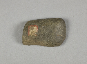
- axe[65]
- bannerstone[4]
- biface[2]
- blade[17]
- borer[4]
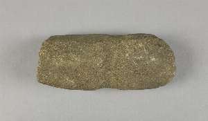
- celt[37]
- celt fragment[1]
- ceremonial object[3]
- chip[5]
- chips[3]
- chisel[9]
- cobble[4]
- core[1]
- dagger[1]
- disk[1]
- drill[21]
- flake[41]
- flakes[4]
- game stone[1]
- gorget[6]
- gorget fragment[1]
- gouge[3]
- gravel[1]
- grinding stone[1]
- grooved axe[1]
- hammer[7]
- hammerstone[19]
- hoe[1]
- implement[120]
- implements[2]
- jasper[1]
- knife[124]
- knives[1]
- lithic[1]
- muller[1]
- net sinker[21]
- net-sinker[1]
- object[1]
- objects[1]
- pebble[69]
- pebbles[2]
- pendant[2]
- perforator[1]
- pestle[4]
- pestle fragment[1]
- pick-axe[7]
- point[322]
- points[2]
- projectile point[183]
- projectile point fragment[1]
- projectile points[17]
- quern[1]
- reject[3]
- rubbing stone[4]
- scraper[53]
- scraper knife[1]
- sinker[4]
- spade[2]
- spearhead[18]
- stone[37]
- teshoa[1]
- tool[35]
- tool fragment[1]
- alaska[4]
- atlantic county[11]
- bainbridge (pennsylvania)[6]
- beaver county[5]
- berks county[314]
- big timber creek[6]
- boyertown[250]
- bristol (pennsylvania)[20]
- bucks county[121]
- burlington county[21]
- burlington island[10]
- cayuga county[45]
- chickies[10]
- claymont[26]
- clinton county[32]
- columbia county[3]
- dauphin county[3]
- delaware[26]
- delaware valley[331]
- delaware water gap[9]
- doylestown[3]
- fairmount park[6]
- frank fox's place[3]
- gaddis run[7]
- gloucester[3]
- gloucester county[12]
- halls island[10]
- hamilton[26]
- hamilton square[26]
- hammonton[11]
- hansell farm[23]
- hick's ferry[3]
- holy cross[3]
- hummel's wharf[14]
- hunlock's creek[3]
- inskip[13]
- iredell's creek[3]
- johnson's creek[10]
- keith manour[12]
- klemson's island[3]
- lancaster county (pennsylvania)[40]
- lawrence county (pennsylvania)[8]
- lehigh county[46]
- livingston county (new york)[4]
- lock haven[31]
- lower yukon river valley[3]
- lumberton[8]
- luzerne county[24]
- macungie[9]
- mahoning beach[9]
- mckees island[4]
- mercer county[336]
- milford (pennsylvania)[13]
- monmouth county[3]
- monroe county (pennsylvania)[10]
- montgomery county (pennsylvania)[6]
- morgantown road[41]
- morris county[5]
- morrisville region[3]
- nescopeck[4]
- new castle county[26]
- new jersey[396]
- new york[70]
- north america[1,307]
- northampton county[4]
- northumberland county[20]
- oley[3]
- pechoqueolin creek[3]
- pennsylvania[786]
- philadelphia[10]
- philadelphia county[10]
- pike county (pennsylvania)[13]
- pohopoco creek[29]
- point pleasant[6]
- pottstown[5]
- pulaski[3]
- pulaski region[12]
- reading (pennsylvania)[15]
- renselaer county[4]
- rock retreat[7]
- sawmill creek[6]
- schuylkill county[9]
- seneca county (new york)[12]
- seneca falls[12]
- snyder county[29]
- stony point[4]
- susquehanna river[28]
- susquehanna river valley[64]
- susquehanna valley[33]
- tioga county[6]
- trenton[305]
- united states of america[1,286]
- vandenburg hill[4]
- vera cruz (pennsylvania)[5]
- wapwallopen[4]
- washington boro[9]
- wayne township[9]
- woodport[5]
- york[15]
- york county (pennsylvania)[15]
- historic[1]
- palaeolithic[1]
- paleolithic[5]
- prehistoric[1]
- algonquin[20]
- hunterdon county[1]
- iroquois[21]
- new jersey[1]
- paleolithic[1]
- prehistoric eskimo[1]
- abbott farm[2]
- banks of laurie's mill pond[7]
- bed of stream[1]
- farm about 3 mi. above lock haven on south bank of west brnach of susquehanne river, surface.[2]
- from ancient quarry[1]
- from ancient quarry.[2]
- from ancient shaft 11 ft deep[1]
- from ancient shaft 16 ft deep.[1]
- from meadows below trenton.[7]
- from road cut[4]
- from roadside gutter[33]
- from roadside gutter.[3]
- from surface near pit.[1]
- from surface of field.[1]
- from workshop[1]
- gravel bluff facing delaware river below trenton[1]
- gravel exposure on jefferson avenue.[3]
- gravel surface of upper end of island.[2]
- gravelly field, surface[1]
- gravelly shore of moon's island, 1.5 miles below trenton nj[1]
- hays stewart farm, operation ii, surface[4]
- in susquehanna river[2]
- indian blade workshop[1]
- indian village site on old keith manour[12]
- laurie's mill pond[2]
- likely indian village located today at laurel hill cemetery[3]
- loose gravel.[1]
- mckinney's farm, mouth of mcelhatten creek, south isde of west branch of susquehanna river, 4 mi. below lock haven. surface[1]
- monro farm, operation i, pit #26, depth 7 in[1]
- monro farm, operation i, test pit #1, depth 17 in[5]
- monro farm, operation i, test pit #2, depth 20 in[1]
- mound[1]
- near cohen island[1]
- operation iii[1]
- operation iii, pit no. e and f, -3[2]
- opposite locust grove haldeman estate[2]
- pine station[3]
- pine station, quiggle farm, operation iii, pit no. e and f, -3. depth, surface to 14 in[2]
- pine station, quiggle farm, operation iii, surface.[4]
- quiggle farm[3]
- shaw's farm, mouth of pine creek, below lock haen on west branch pf susquehanna river, surface[6]
- surface[22]
- surface of "trenton gravel"[1]
- surface of field[4]
- surface of trenton gravel[1]
- talus. river bank.[1]
- this from gravel thrown out in digging sewer trench in center street.[2]
- upper creek[1]
- village site and quarry[1]
- west of morrisville, gravel[4]
- workshop in ancient quarry.[4]
- yes[21]

1 - 32 of 1,307 Records

1 - 32 of 1,307 Records