

Search Collections
- Object[353]
- yes[353]
- african[1]
- american[201]
- asian[17]
- egyptian[2]
- european[29]
- mediterranean[1]
- near eastern[3]
- oceanian[99]
- alaska[8]
- alibates creek[5]
- alpes-maritimes[2]
- anderson lake[2]
- arizona[8]
- australia[98]
- banquete creek[4]
- baousse-rousse caves[2]
- berks county[12]
- bisitun[2]
- bivens estate ranch[5]
- boyertown[11]
- brackettville[2]
- bucks county[17]
- burlington county[2]
- cape prince of wales[5]
- chubu region[2]
- clinton county[7]
- clovis[6]
- colorado[10]
- corpus christi[7]
- culberson county[2]
- david rose's ranch[2]
- delaware[2]
- delaware valley[21]
- delaware water gap[10]
- dordogne[6]
- durango[2]
- egypt[2]
- europe[18]
- fort sully[2]
- france[8]
- freehold[2]
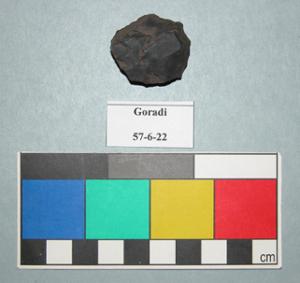
- goradi[4]
- gravel pit[3]
- guadalupe mountains[2]
- harding county[3]
- hokkaido[3]
- honshu[9]
- hughes county[2]
- india[4]
- iran[3]
- japan[13]
- kanagawa prefecture[7]
- kent county (delaware)[2]
- kermanshah province[2]
- lendsey farm[2]
- live oak peninsula[6]
- lock haven[7]
- logan (new mexico)[2]
- mentone[2]
- mercer county[21]
- mexico (central america)[2]
- mississippi[3]
- monmouth county[2]
- monroe county (pennsylvania)[10]
- montgomery county (pennsylvania)[3]
- muerto creek[3]
- murchison district[2]
- nagano prefecture[2]
- near abilene[2]
- near bueyeros[3]
- near clovis[2]
- near hobart[64]
- new jersey[30]
- new mexico[25]
- north america[94]
- northern australia[4]
- nueces county[14]
- nueces dam[7]
- pennsylvania[60]
- petersborough[2]
- petronillo creek[2]
- point pleasant[3]
- polard lake[5]
- pottstown[3]
- quay county[4]
- richmond (australia)[23]
- riegelsville[2]
- rincon[5]
- san patricio county[7]
- shinshiu[2]
- site 1[2]
- site 10[5]
- site 5[2]
- smith creek[2]
- south dakota[3]
- southeastern australia[22]
- southeastern utah[3]
- susquehanna river valley[2]
- tasmania[65]
- texas[43]
- tomabetsu[2]
- trenton[21]
- united states of america[156]
- utah[7]
- victoria (australia)[23]
- western australia[3]
- williams cave[2]
- yokohama[7]
- kourion[1]
- algonquin[6]
- ancestral pueblo[5]
- athapaskan[1]
- chalchihuites[2]
- cliff dweller[3]
- cypriot[1]
- danubian culture[1]
- eskimo[8]
- indian[4]
- iroquois[4]
- japanese[10]
- jomon[13]
- late paleolithic[1]
- mesolithic[1]
- neolithic[1]
- paleolithic[6]
- pecos cave dweller[2]
- sassanian[1]
- sioux[1]
- wardaman[4]
- yayoi[6]
- "dirt lodges"[3]
- 103.1ew 102.4ns[1]
- 15 miles north of fort pierre[1]
- 2 mi. w. of gravel pit near clovis, n.m.[1]
- 4th grotto[2]
- abbott farm[1]
- anderson lake, about 15 mi. s.e. of clovis, n.m.[1]
- approximate 7' level near front of pit.[1]
- bluffs north of peoria bottom[1]
- burnt mound[2]
- callo del oso[1]
- cemetary b[1]
- dr. ray's site on clear fork of brazos river.[1]
- from "blow-cuts" near finley site, near eden; on surface[1]
- from roadside gutter[1]
- from rock shelter[1]
- from surface on flood plain of delaware river[1]
- gravel pit[1]
- hays stewart farm, operation ii, surface[2]
- house 2 entrance[1]
- house ruin above second bench above cannery.[1]
- indian village[3]
- jasper quarry[1]
- lofland and gooden farms on either side of cor marsh ditch[2]
- mescal pit in small canyon north of dark canyon near carlsbad, n.m.[1]
- near jamshedpur[4]
- one mile south of fort sully[2]
- pine station, quiggle farm, operation iii, pit no. g and h, -1 and -2. depth not recorded.[1]
- shaw's farm, mouth of pine creek, below lock haen on west branch pf susquehanna river, surface[2]
- shell mounds[1]
- surface[9]
- surface around gravel pit near clovis, n.m.[1]
- tomb 12:n[1]
- vicinity, surface[2]
- willamette river[1]
- yes[28]

1 - 32 of 353 Records