
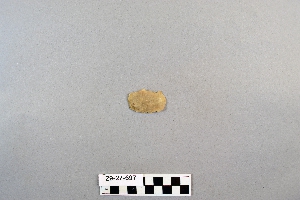
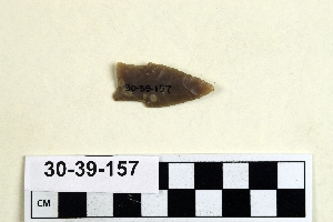
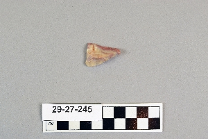
Search Collections
- Object[1,081]
- yes[1,081]
- no[1,081]
- american[1,019]
- egyptian[7]
- european[27]
- near eastern[3]
- oceanian[25]
- arrowhead[1]
- blade[6]
- cast[2]
- convergent-concave scraper[1]
- crescent[1]
- flake[2]
- flakes[1]
- knife[1,081]
- perforator[1]
- point[5]
- projectile point[277]
- racloir[5]
- scraper[37]
- spear point[1]
- abilene[11]
- abydos[3]
- adams county (mississippi)[2]
- alaska[15]
- albany county[4]
- albany region[4]
- alibates creek[33]
- anclota estuary[8]
- anderson lake[13]
- antelope creek[15]
- australia[25]
- ballas[2]
- beck forest lake[3]
- berks county[13]
- bivens ranch[5]
- blowout mountain[8]
- brownsville[18]
- bucks county[6]
- buffalo gap[9]
- canadian river[112]
- chester county[3]
- clovis[7]
- cottonwood creek (texas)[33]
- deal[16]
- denmark[6]
- duval county[2]
- east tennessee[220]
- eastern pennsylvania[5]
- eastern united states[2]
- eddy county[5]
- egypt[7]
- elgin[259]
- elm creek[17]
- england[14]
- farm of william holocher[4]
- fayette county (pennsylvania)[18]
- florida[17]
- forest heath district[11]
- gould ruin[11]
- gravel pit[2]
- green river[2]
- gulf of mexico[2]
- handley ranch[11]
- hans hoch's fields[2]
- high terrace[3]
- icklingham[2]
- indian hill[16]
- kansas[4]
- kings ruins[17]
- kraale[8]
- lancaster county (pennsylvania)[5]
- landergin[31]
- lehigh county[5]
- lendsey farm[11]
- little pine canyon[3]
- locust grove[2]
- logan (new mexico)[18]
- mathews ranch[3]
- mercer county[4]
- mississippi[2]
- missouri[3]
- monongahela river[18]
- morrisville[4]
- naqada[3]
- natchez (mississippi)[2]
- near abilene[70]
- near albany[3]
- near englewood[4]
- new jersey[16]
- new mexico[47]
- new york[4]
- north america[128]
- nueces county[2]
- padre island[2]
- pennsylvania[119]
- pinellas county[8]
- pit house[4]
- point barrow[6]
- point barrow region[3]
- point hope[3]
- port phillip bay[25]
- potter county (texas)[15]
- pricetown[9]
- quay county[18]
- ralph thayer ranch[3]
- rosson's ranch[3]
- scandinavia[9]
- site 8[13]
- smith county[6]
- southeastern australia[25]
- southeastern utah[3]
- tennessee[15]
- texas[557]
- trenton[4]
- united states of america[984]
- volusia county[3]
- wainwright[3]
- wolf creek[11]
- wyatt farm[10]
- wyoming[3]
- mount royal[1]
- basket-maker[1]
- basketmaker[1]
- canaanite[1]
- eskimo[13]
- inuit[2]
- mousterian[1]
- neolithic[16]
- neolithic iii[2]
- pecos cave dweller[2]
- pueblo[2]
- st. johns ii[1]
- upper acheulian[1]
- zuni[1]
- "johnny-behind-the-deuce cave"[3]
- 0.75 mi. beyond bridge[4]
- 38, 190, vi[1]
- 65, 220 v[1]
- altona[1]
- archaeological site number: 8vo31 or 8vo32[1]
- basin site[1]
- below surface/above main floor of burnt house[2]
- chemin de poste quarry[1]
- creek bed of elm creek 7.5 mi. south of abilene[3]
- elm creek surface site[4]
- eusebio cubero quarry[1]
- field 335[1]
- found in neighborhood of elgin[1]
- from "blow-outs" near finley site, near eden[1]
- from brandywine (laubach) camp-site.[2]
- from lake bank 1 mi. s.e. of gravel pit near clovis, n.m.[1]
- from roadside gutter[1]
- from rock shelter[1]
- from ruin along ancient ditch[1]
- g570[1]
- gr753[1]
- gravel pit[9]
- in situ 1.5 meters below the surface[1]
- level f[1]
- mesa site[13]
- near mount royal[1]
- near mouth of elm creek[9]
- one foot down.[1]
- orange grove[1]
- paint creek[9]
- pit house floor[4]
- rossen's ranch near lawn[3]
- rowland's farm[1]
- ruin along ancient ditch near englewood[3]
- sand dune surface site near nugent[1]
- shell ridges[1]
- shell ridges, near surface[1]
- shores of delaware river at morrisville, pa., and trenton, n.j.[4]
- site 48 (dewitt farm)[1]
- surface[21]
- surface near deal[13]
- surface site[24]
- surface site 12 miles so. of alamogordo[1]
- surface site in cotton field 1 mi. e. of lawn[2]
- surface site in cotton field mile e. of lawn[16]
- surface site near abilene[9]
- surface.[1]
- tomb of khasekhemwy (tomb v)[1]
- walled cave rocky arroyo seep 50-60 miles west of carlsbad[1]
- yes[22]


1 - 32 of 1,081 Records