
Search Collections
- Object[328]
- yes[328]
- american[225]
- egyptian[8]
- european[40]
- near eastern[53]
- oceanian[2]
- animal bone[1]
- arrow[1]
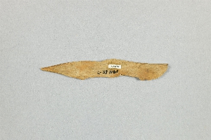
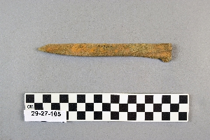
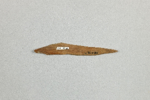
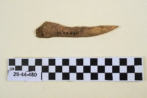
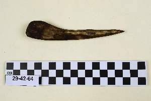
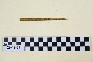
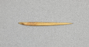
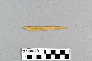
- awl[328]
- bodkin[21]
- chisel[2]
- fragment[2]
- game piece[1]
- marlin[5]
- needle[1]
- needle case[1]
- point[1]
- sheath[1]
- thimble[1]
- abri blanchard[10]
- alaska[40]
- antelope creek[2]
- arizona[4]
- baja california[1]
- bern canton[4]
- between san juan and colorado rivers[20]
- billa[4]
- black dyke[1]
- boyd cave[2]
- british new guinea[1]
- california (state)[1]
- canada[13]
- canadian river[5]
- canyon[2]
- cape denbigh[9]
- carlisle[1]
- cayuga county[6]
- cheka sabz[3]
- cliff house[11]
- clinton county[1]
- cockburn point[1]
- colorado[2]
- coronation gulf[1]
- corpus christi[2]
- cottonwood creek (texas)[1]
- culberson county[2]
- cumberland county (pennsylvania)[1]
- dauphin county[1]
- dordogne[11]
- eastern united states[3]
- eddy county[1]
- egypt[4]
- el-mahasna[1]
- england[1]
- ewing and bragdon site[3]
- first mesa[1]
- fort pierre[1]
- fort pierre chouteau[1]
- france[11]
- frenchman's bay[3]
- guadalupe mountains[4]
- hancock county (maine)[3]
- handley ranch[1]
- hasanlu[6]
- holland[2]
- humboldt county[1]
- hummelstown cave[1]
- iran[29]
- iraq[24]
- iyatayet[9]
- kamterlan[3]
- kara tepe (iraq)[2]
- kerma[4]
- koots canyon pueblo[3]
- kroenig ranch[2]
- labatut[10]
- labrador[8]
- lake biel[9]
- lake neuchatel[7]
- lake pfaffikon[6]
- maine[3]
- morigen[3]
- new guinea[2]
- new mexico[39]
- new york[7]
- nippur[2]
- north america[12]
- norton sound[9]
- nueces county[2]
- nuwuk[2]
- oregon[6]
- pennsylvania[3]
- point barrow region[20]
- point hope[7]
- pueblo mound[2]
- quebec[2]
- rawhide canyon[2]
- rio grande region[27]
- robenhausen[7]
- roches de sergeac[10]
- san juan county (new mexico)[3]
- san juan drainage[27]
- san juan drainage area[19]
- site 9[2]
- southeast canada[2]
- southeastern utah[83]
- southwest colorado[16]
- sudan[4]
- switzerland[26]
- tepe gawra[15]
- tepe hissar[14]
- texas[11]
- tureng[3]
- united states of america[163]
- utkiavik[17]
- watrous[4]
- williams cave[2]
- yukon island[2]
- zurich canton[6]
- iyatayet[9]
- billa iii[1]
- billa vi[1]
- early 20th century[1]
- egyptian predynastic period[1]
- gawra x[2]
- gawra xi[1]
- gawra xia[1]
- gawra xii[4]
- gawra xiii[1]
- gawra xiv[2]
- gawra xix[1]
- gawra xv[1]
- gawra xvii[1]
- gawra xviii[2]
- hasanlu period iv[1]
- hissar ia[9]
- hissar ib[6]
- hissar iib[1]
- ilkhanid period[1]
- magdalenian[1]
- middle aurignacian[10]
- migration period[2]
- neolithic[26]
- parthian[1]
- pre-sargonid[1]
- upper aurignacian[10]
- algonkin[1]
- basket maker[1]
- basket-maker[16]
- classic kerma[4]
- cliff dweller[60]
- eskimo[32]
- hopi[4]
- hupa[1]
- kachemak bay culture iii[2]
- magdalenian[1]
- middle aurignacian[10]
- naskapi[11]
- neolithic[9]
- nukleet[9]
- pecos cave dweller[2]
- prehistoric eskimo[2]
- pueblo[2]
- seri[1]
- shoshone[1]
- swiss lake dweller[26]
- upper aurignacian[10]
- "dirt lodges"[1]
- 15 miles north of fort pierre[1]
- 4 k, 3'3" - 3'9"[2]
- 6 m [10 m][1]
- bluffs north of peoria bottom[1]
- cave 50-60 miles west of carlsbad[2]
- h 27, level vi[1]
- indian village[1]
- iy[1]
- iyed[1]
- iyed mid[2]
- iyem[1]
- iyem b-i[1]
- iyem upper[3]
- k 26, level iii[1]
- layer 8[2]
- level x[2]
- level xi[1]
- level xia[1]
- level xii[4]
- level xiii[1]
- level xiv[2]
- level xv[1]
- level xvii[1]
- level xviii[1]
- level xviii - xix[1]
- operation iii, pit # 200, section c -6[1]
- period ii b[1]
- pine station[1]
- quiggle farm[1]
- reservation 6 miles south of maniwaki[1]
- s[4]
- t 282[1]
- t. 163[1]
- tepe gawra, 3 m, well[1]
- tepe gawra, 4 j[1]
- tepe gawra, 4 j, 3;25[1]
- tepe gawra, 4 k[2]
- tepe gawra, 4 m [10 p][1]
- tepe gawra, 5 '0' [9 n][1]
- tepe gawra, 5 k[1]
- tepe gawra, 5 q[1]
- tepe gawra, 5 q [8 n][1]
- tepe gawra, 6 n [10 m][1]
- tepe gawra, 7 q[1]
- tepe gawra, 8 m[1]
- tepe gawra, well[1]
- walled cave rocky arroyo seep 50-60 miles west of carlsbad[1]
- pete dube[1]
- yes[40]

1 - 32 of 328 Records