
Search Collections
- Object[1,078]
- yes[1,078]
- adze[1]
- adze blade[2]
- architectural relief[1]
- arrow[5]
- arrowhead[16]
- arrowheads[2]
- awl[1]
- axe[2]
- balustrade[1]
- base[1]
- beads[2]
- blade[19]
- blade fragment[1]
- blades[3]
- blank[2]
- boulder (stone)[1]
- bowl[1]
- building fragment[1]
- burin[1]
- celt[14]
- chip[2]
- chips[1]
- cleaver[2]
- club head[1]
- column[1]
- column fragment[3]
- core[4]
- disc[4]
- discoidal[1]
- double-ended nucleiform scraper[4]
- double-ended nucleus[1]
- drill[3]
- end scraper[13]
- flake[66]
- flake blade[4]
- flake blade fragment[2]
- flake knife[1]
- font yves point[2]
- game stone[2]
- gorget[1]
- graver[1]
- hammer[2]
- hammerstone[20]
- hand axe[1]
- hand-axe[2]
- hatchet[2]
- hide scraper[3]
- hoe[1]
- implement[5]
- keeled scraper[27]
- knife[202]
- knife blade[2]
- levallois flake[4]
- lithic[15]
- mallet head[4]
- mano[1]
- marble (game)[4]
- metate[1]
- mortar[2]
- muller[1]
- net sinker[2]
- nosed keeled scraper[1]
- notched axe[1]
- nucleus (lithic)[3]
- object[2]
- paint stone[1]
- pebble[12]
- pendant[2]
- percuteur[1]
- perforator[1]
- pestle[3]
- plummet[1]
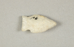
- point[267]
- points[1]
- projectile point[121]
- projectile points[1]
- punch[1]
- quartz fragment[1]
- quartzite[1]
- racloir[1]
- reject[1]
- relief[2]
- round scraper[4]
- scraper[65]
- scraper-burin[2]
- side scraper[15]
- spall[5]
- spear point[7]
- spearhead[29]
- statuary[2]
- statue[4]
- statue fragment[2]
- stone[4]
- stone chip[2]
- stone fragment[5]
- teshoa[7]
- thumbnail scraper[2]
- tool[10]
- utilized flake[4]
- war club[2]
- alabama[4]
- alicedale[4]
- anderson lake[7]
- arizona[6]
- asheville[4]
- auburn[4]
- australia[35]
- bainbridge (pennsylvania)[8]
- beck forest lake[13]
- berks county[112]
- big timber creek[17]
- birchrunville[5]
- bridger basin[4]
- bristol (pennsylvania)[7]
- brunswick county[8]
- bucks county[17]
- burlington county[15]
- castel merle[12]
- chester county[83]
- chickies[28]
- clovis[42]
- colorado[6]
- curry county[4]
- delamere caves[12]
- delaware[16]
- delaware county (pennsylvania)[7]
- delaware valley[16]
- dordogne[13]
- eastern cape[4]
- eastern pennsylvania[20]
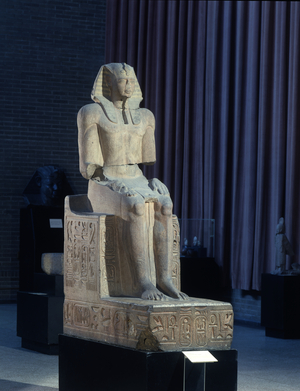
- egypt[20]
- el-amarna[10]
- florida[7]
- france[22]
- gloucester county[20]
- gravel pit[19]
- great plains (plain)[4]
- hans hoch's fields[7]
- hernando county[5]
- iraq[6]
- john's island[4]
- kentucky[8]
- kintnersville[5]
- lake[4]
- lancaster county (pennsylvania)[220]
- lee county (alabama)[4]
- lehigh county[5]
- locust grove[9]
- lodge pole trail[4]
- logan (new mexico)[28]
- louisiana[4]
- markham[6]
- medford[4]
- mercer county[18]
- milford road[57]
- miniosa draw[6]
- mit-rahineh[5]
- montgomery county (pennsylvania)[18]
- mugharet el wad[80]
- near clayton[7]
- near clovis[7]
- near dalhart[7]
- near eden[7]
- near nara visa[6]
- near tucumcari[4]
- new jersey[95]
- new mexico[124]
- new zealand[5]
- north america[639]
- north carolina[4]
- northern australia[12]
- ohio[8]
- oley[46]
- overpeck site[5]
- palestine[80]
- pennsylvania[534]
- pottstown[12]
- pricetown[36]
- quay county[47]
- riverton[5]
- rock retreat[14]
- schuylkill county[5]
- south africa[5]
- south dakota[7]
- south island, new zealand[5]
- southland region[5]
- susquehanna river[4]
- sweetwater county[7]
- tepe gawra[4]
- texas[11]
- trenton[16]
- union county (new mexico)[8]
- united states of america[785]
- utah[6]
- uwchlan township[57]
- virginia[8]
- washington boro[53]
- white river[6]
- witmer's farm[43]
- wyoming[48]
- finley site[1]
- amarna period[1]
- aurignacian[1]
- early archaic[3]
- early woodland period[7]
- eighteenth dynasty[6]
- gawra viii[2]
- gawra viiib[1]
- gawra xii[1]
- late archaic[8]
- late period[3]
- lower mousterian[6]
- mesolithic[1]
- middle archaic[1]
- middle kingdom[1]
- modern[1]
- mousterian[9]
- neolithic[3]
- new kingdom[9]
- nineteenth dynasty[2]
- paleoindian[1]
- prehistoric[2]
- te puawaitanga period[5]
- thirteenth dynasty[1]
- thirtieth dynasty[1]
- twenty-sixth dynasty[1]
- upper mousterian[5]
- acheulian[1]
- ancestral pueblo[6]
- atlitian[3]
- aurignacian[1]
- bannock[1]
- basket-maker[1]
- cherokee[4]
- chipal 2[1]
- cliff dweller[2]
- cody cultural complex[1]
- early post-classic[1]
- highland maya[1]
- indian[1]
- leni lenape[5]
- lower aurignacian[9]
- lower mousterian[6]
- maori[5]
- middle aurignacian[52]
- middle woodland[1]
- mousterian[34]
- neolithic[3]
- pueblo[2]
- shoshone[2]
- shoshonean[3]
- sioux[3]
- swiss lake dweller[2]
- upper levallois[25]
- upper mousterian[5]
- ute[3]
- wardaman[12]
- woodland[57]
- 2 mi. w. of gravel pit near clovis, n.m.[2]
- 20 miles from cody[3]
- alongside mammoth tusk[1]
- alongside of mammoth tusk[1]
- anderson lake, about 15 mi. s.e. of clovis, n.m.[5]
- basin site[2]
- bison kill/processing area[1]
- c : top of upper mousterian level.[1]
- c2[1]
- camp site[3]
- cave[3]
- embedded in blue sand[1]
- excavated from small mound[1]
- field near town[1]
- first terrace surface[3]
- found in grading roadway.[1]
- found near bottom of blue sand. association with bison at gravel pit[2]
- from "blow-outs" near finley site, near eden[6]
- from brandywine (laubach) camp-site.[1]
- from lake 3 mi. w. of gravel pit near clovis n.m.[1]
- from lake 3 mi. w. of gravel pit near clovis, n.m.[2]
- from old lake 1.5 mi. s.w. of gravelpit about 18 mi. s.w. of clovis[2]
- from rock shelter[2]
- from workshop on gravel terrace, northeast of farson[6]
- gravel pin 15 miles sw of clovis[1]
- island in susquehanna river[18]
- k c[1]
- killpecker dune field[1]
- lake 15 mi. west[1]
- layer of erosion[4]
- level 8 b[1]
- level 8, trial trench[2]
- level c[3]
- level d 1[12]
- level d 2[23]
- level e[17]
- level f[4]
- level f, layer of erosion[5]
- level g 1[5]
- level g 2[6]
- level g 3[2]
- level g 4[1]
- level g 6[1]
- level g 9[1]
- level xii[1]
- likely indian village located today at laurel hill cemetery[1]
- lofland and gooden farms on either side of cor marsh ditch[3]
- lower mousterian level[6]
- lower terrace[1]
- moores isle[1]
- mound[2]
- mound (historical attribution)[8]
- mound a, top digging,[1]
- near jamshedpur[1]
- old lake 2 mi. south of gravel pit near clovis, n.m.[3]
- old lake west of gravel pit near clovis, n.m.[1]
- palmer's corner[1]
- river bank[1]
- room 101[1]
- ruin along ancient ditch near englewood[1]
- sand "blowout" 20-25 miles northeast of carlsbad[2]
- shell heap[4]
- shores of delaware river at morrisville, pa., and trenton, n.j.[1]
- site 1[1]
- south portal[1]
- strip 100e[1]
- sub 8[1]
- surface[23]
- surface 100 yds. west of gravelpit about 17 mi. s.w. of clovis[1]
- surface find along cohansey creek[1]
- surface in blown area[4]
- surface, blown area[3]
- temple of el-amarna[1]
- tepe gawra, 5 '0' [9 n][1]
- vestibule of the temple of herishef[1]
- workshop on gravel terrace, northeast of farson[7]
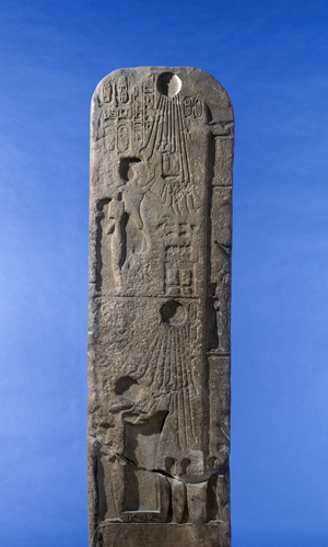
- hieroglyphic[12]
- agate[1]
- amber[1]
- amethyst[2]
- animal bone[1]
- argellite[1]
- argillite[2]
- barite[1]
- basalt[1]
- carnelian[1]
- chert[6]
- coral[1]
- feather[4]
- flint[8]
- garnet[1]
- glass[1]
- granite[1]
- gum[1]
- hematite[1]
- jadeite[1]
- jasper[8]
- lapis lazuli[1]
- limestone[1]
- obsidian[1]
- paste[1]
- quartz[1]
- quartzite[1,078]
- red jasper[1]
- rhyolite[2]
- sandstone[4]
- shale[1]
- shell[1]
- sinew[1]
- slate[1]
- stone[11]
- wood[5]
- chipped[514]
- ground[2]
- ground stone[1]
- incised[1]
- inscribed[1]
- notched[1]
- painted[1]
- pecked[1]
- perforated[1]
- sunk relief[1]
- yes[58]

1 - 32 of 1,078 Records