

Alaskan Expedition, Frederica de Laguna, 1930
Accession Lot
- Object[63]
- no[63]
- american[63]
- adze[5]
- adze head[1]
- adze point[1]
- arrowhead[1]
- awl[2]
- beach pebble[1]
- blade[1]
- boulder (stone)[1]
- boulder chip[1]
- cleaver[1]
- crayon[1]
- fragment[3]
- grinding stone[1]
- grindstone[1]
- knife[3]
- lamp[7]
- mattock blade[1]
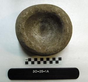
- mortar[1]
- object[3]
- pebble[2]
- pestle[2]
- pick[1]
- pin[1]
- planing adze[1]
- planing adze blade[1]
- pounding stone[2]
- scraper[6]
- splitting adze[10]
- stone[1]
- throwing stone[2]
- toy[1]
- ulo[1]
- ulu blade[1]
- wedge[1]
- whetstone[3]
- alaska[61]
- anderson bay[3]
- angiartunit[2]
- angiluk[2]
- axlatuliq[8]
- bainbridge island[2]
- cape starichkof[1]
- chiktaruik[1]
- cook inlet[29]
- cottonwood creek (alaska)[7]
- east beach[1]
- ellamar[1]
- fish creek[2]
- fish creek indian reserve[2]
- galena bay[1]
- halibut cove[3]
- hawkins cut-off[5]
- hawkins island[3]
- heisson[2]
- hinchinbrook island[13]
- ishmailoff island[3]
- kachemak bay[19]
- kenai[2]
- kongoqrli[1]
- kustatan/west foreland[6]
- long bay[1]
- mummy island[4]
- nuchek[1]
- nunakchuk[5]
- paingwashaq[1]
- palu:tat[1]
- palugvik village[2]
- point whitshed radio station[1]
- prince william sound[32]
- sheep bay[1]
- tauxtvik[1]
- united states of america[61]
- uqshitoq[1]
- washington (u. s. state)[2]
- west beach[6]
- yukon island[9]
- 1' below surface of midden[1]
- 1' below surface of midden at north beach.[1]
- 14" deep in midden.[1]
- 2 ' below surface.[3]
- 3 ' below surface.[1]
- 3 ' to 4 1/2 ' below surface.[1]
- 3 1/2 ' below surface[1]
- 4 ' below surface.[1]
- 4 1/2 ' below surface.[1]
- 5 ' below surface.[1]
- 9 ' below surface[1]
- 9 ' below surface.[1]
- about 1 1/2 ' below surface of midden[1]
- about 1 1/2 ' below surface of midden.[2]
- beach[2]
- beach on northeast point[1]
- beach on south side of northeast point[1]
- beach on the south side of northeast point[1]
- beach on the south side of the northeast point.[1]
- beach.[4]
- east beach, mound 1. 3' below surface.[1]
- east beach.[1]
- found in an abandoned house.[1]
- found on beach.[8]
- found on cannery site, probably from old village of sustin[1]
- hole 2.[1]
- house ruin above second bench above cannery.[5]
- in midden rubbish.[1]
- in very shallow midden.[1]
- midden - west point - 3' 6" above bottom.[1]
- midden, g 1 ' below surface.[1]
- midden.[1]
- mound 2[1]
- not over 3 ' below surface.[1]
- nunakchuk[1]
- philip amarus farm (20 miles northeast of vancouver, washington)[2]
- pit 2[1]
- pit 3[4]
- top layer of midden.[1]
- wunqra[1]
- stone[63]

1 - 30 of 63 Records



1 - 30 of 63 Records